
West Virginia, it looks like winter isn’t quite ready to let go just yet. While spring is officially here, it seems we’re getting one last reminder that snow is still possible. Starting today and continuing through Wednesday morning, we can expect light snow showers across the state, with a few inches accumulating in the higher elevations. It won’t be a huge snowstorm, but enough to cause some trouble on the roads and make things a little slippery. Here’s what you need to know to stay safe.
What’s Happening:
-
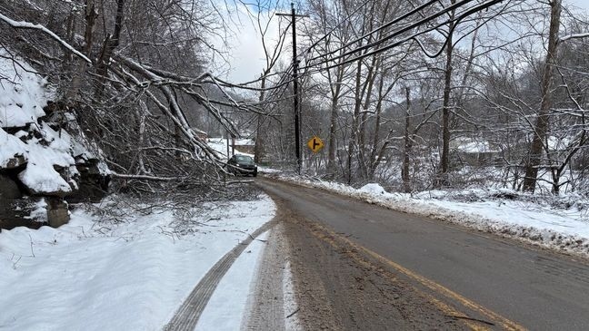
Light Snow Showers: We’re in for some snow, but nothing too heavy. Expect light snow showers to move through the state starting today. It’s not going to be anything like a blizzard, but these snow showers could still make your commute a little tricky, especially if you’re traveling in the mountains where the snow is likely to accumulate more.
-
When to Expect It: The snow will stick around through Wednesday morning before it finally starts clearing up. The heaviest snow will fall today and tomorrow, but by Wednesday afternoon, things should start to improve, and the snow will taper off.
-
Road Conditions: Even light snow can cause problems, especially if the roads are untreated. Keep an eye out for slippery spots, particularly on secondary roads, bridges, and overpasses, which freeze quicker. If you’re heading into the mountainous areas, the snow might hang around longer, making driving conditions even more difficult.
What to Expect:
-
Monday (March 24): Snow showers are already starting to make their way across the state today. Expect temperatures in the 30s, so any snow that falls could stick, making roads a little slick, especially as the day goes on. If you’re driving this evening, be extra cautious as the snow picks up. Higher elevations will see more snow accumulation, so if you’re heading to the mountains, take extra care.
-
Tuesday (March 25): Snow will continue into Tuesday, with light flurries throughout the day. The roads will be tricky, particularly in the morning and evening when everyone is commuting. Mountain areas could see a few inches of snow, so if you live or drive in those areas, be prepared for some slow travel. Temperatures will hover around the low 30s, meaning snow and ice will stick around longer.
-
Wednesday (March 26): By Wednesday morning, the snow will start easing up, and by midday, we should be mostly in the clear. That said, be aware of icy patches on the roads, especially if you’re out early. The mountainous regions might still have some lingering snow, so be cautious if you’re heading into the higher elevations.
How to Stay Safe:
-
Drive Safely: Even though this won’t be a major snowstorm, the roads could still get slippery, so slow down and allow extra time if you’re driving. Pay close attention on bridges and overpasses, as they freeze quicker than regular roads. If you’re headed to the mountains, expect more snow and longer-lasting snow on the roads, so be prepared for delays.
-
Watch for Slippery Sidewalks: Snow on sidewalks and driveways will likely turn into ice, especially overnight. If you’re out walking, take it slow, and watch your step. If you can, spread some salt on your driveway or walkway to help prevent any ice buildup.
-
Stay Informed: Weather can change fast, so keep an eye on the forecast throughout the day. Snow will taper off by Wednesday afternoon, but conditions may still be tough for the morning commute, particularly if you’re heading into higher elevations.
Why This Happens:
It might feel like spring is just around the corner, but West Virginia’s weather can be a bit unpredictable at this time of year. Late March can still bring winter-like conditions, and with temperatures hovering in the low 30s, snow showers are still possible. This is a typical weather pattern for the state, where we sometimes get a little extra winter mixed in with the first signs of spring. Fortunately, this snow won’t be around long, and by midweek, we’ll be back to clearer skies.
Quick Recap:
-
What to Expect: Light snow showers continuing through Wednesday morning, with temperatures in the 30s. Snow will likely stick more in the higher elevations, with some accumulation possible.
-
When: The snow will last through Wednesday morning, tapering off by midday.
-
What You Can Do: Drive carefully, especially in the mountains, where snow will stick around longer. Watch out for icy sidewalks and keep updated on the weather, especially if you’re traveling during the morning hours.
While it’s hard to believe with spring just starting, this is just one final snow before we fully transition into the warmer season. Stay safe, dress warmly, and be ready for the roads to improve by Wednesday afternoon. Hopefully, this will be the last bit of winter, and soon enough, we’ll be saying goodbye to the snow and hello to warmer days!

