
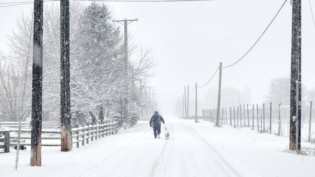
April may be here, but winter still has something to say about it. A Spring Storm Warning is in effect for Grand Forks and surrounding areas until 7 PM tonight, with up to 4 inches of snow expected before the system moves out. For those hoping for sunshine and warm breezes, Mother Nature has other plans—wet snow, gusty winds, and slippery roads are making a not-so-welcome appearance today.
What’s Going On?
This fast-moving spring storm is rolling through eastern North Dakota, bringing wet, slushy snow that’s sticking just enough to slow down traffic and make roads messy. By the time the snow tapers off later tonight, totals could reach anywhere from 2 to 4 inches, and thanks to temperatures hovering in the low 30s, you can expect some icy patches too.
Adding to the fun, wind gusts up to 25 MPH will make it feel colder than it actually is, while also reducing visibility on the roads. If you were planning on heading out, be prepared for slower travel times and slick conditions, especially during the evening commute.
Why You Should Care
No, this isn’t a full-blown blizzard, but it’s still enough to make life a little more complicated today. Driving could be a hassle, sidewalks might be extra slick, and if you were hoping for an easy spring day, you might want to hold off on packing away your winter coat just yet.
If you’re commuting home later, allow for extra time—slushy roads and poor visibility could lead to slower speeds and possible accidents. And while main highways might be plowed quickly, side streets, driveways, and parking lots could stay icy well into the night.
Key Takeaways:
-
Spring Storm Warning active until 7 PM tonight for Grand Forks and surrounding areas.
-
Total snowfall: Between 2 to 4 inches of wet, slushy snow.
-
Wind gusts: Up to 25 MPH, making it feel even colder.
-
Road conditions: Slippery, especially during the evening commute.
What Happens Next?
The snow should start easing up by 7 PM, but don’t expect things to feel much better overnight. With temperatures dropping below freezing, any wet roads or slush could turn into ice, making for a tricky Thursday morning commute as well.
Looking ahead, Thursday will be dry but chilly, with highs only reaching the upper 30s. It won’t feel much like spring yet, but warmer temperatures are expected to return by the weekend—fingers crossed!
How to Handle This Weather Like a Pro
-
Drive carefully: Snow-covered and slushy roads can be just as dangerous as ice, so take it slow.
-
Watch for black ice: With overnight temperatures dropping, any leftover moisture could freeze up by morning.
-
Dress in layers: That wind chill will be biting, so keep the winter coat handy.
-
Stay flexible: If you don’t have to go out, waiting until conditions improve is always a smart move.
Welcome to spring in North Dakota, where winter loves an encore performance. This snowstorm isn’t the worst we’ve seen, but it’s just enough to remind us that Mother Nature plays by her own rules. Stay warm, stay safe, and if you were hoping for spring weather soon—just hang in there, it’s coming!

