
Houston, prepare for a day of extreme weather as a powerful storm system barrels toward Southeast Texas, bringing tornado risks, severe thunderstorms, and potential flash flooding. Forecasters are warning that conditions could quickly turn dangerous, with giant hail, damaging winds, and flooding all possible within a matter of hours.
If you thought March would bring calm, spring-like weather, think again—this storm is packing enough power to disrupt travel, knock out power, and put thousands at risk of dangerous conditions. The worst of the storms is expected Tuesday morning into the afternoon, meaning the morning commute could be a nightmare and flash floods could quickly develop in low-lying areas.
Here’s everything you need to know about this fast-moving, potentially destructive system—and how to keep yourself safe.
When Will the Storm Arrive?
The worst weather is expected on Tuesday, March 5, with intense thunderstorms rolling into the Houston area in the early morning and lasting through the afternoon.
- Tuesday Morning (6 AM – 10 AM): Thunderstorms begin moving into the Houston metro, bringing heavy rain, strong winds, and the first signs of storm activity. Some early tornado warnings are possible.
- Tuesday Late Morning to Afternoon (10 AM – 3 PM): This is the most dangerous period, with the potential for severe thunderstorms capable of producing tornadoes, giant hail, and hurricane-force wind gusts. This will be Houston’s highest-risk window for violent weather.
- Tuesday Evening (3 PM – 7 PM): The storm system begins moving east, but lingering thunderstorms and flash flooding will remain a concern. Some areas may still experience damaging winds and isolated downpours.
What Makes This Storm So Dangerous?
This storm isn’t just an ordinary rain event—it’s shaping up to be one of the most intense severe weather threats of the season. Here’s what makes it so concerning:
- Tornadoes Are Possible – Forecasters say atmospheric conditions are perfect for tornado development. If a tornado warning is issued, take cover immediately!
- Giant Hail Could Damage Homes & Cars – Some areas may see hail the size of golf balls or even baseballs, capable of shattering windshields and damaging rooftops.
- Destructive Winds Over 70 MPH – Winds this strong can knock down trees, power lines, and even damage buildings.
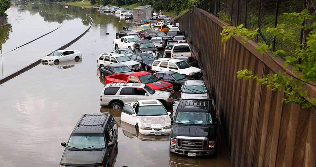
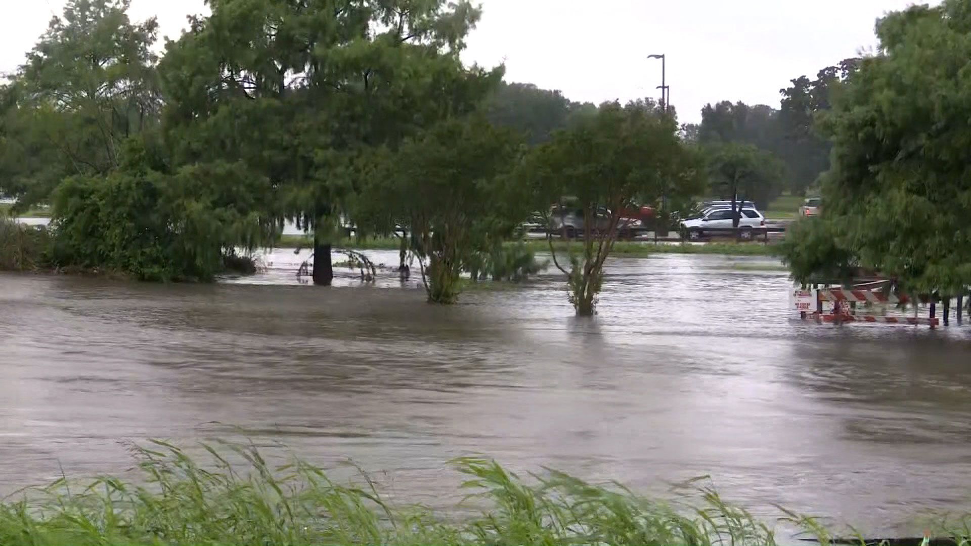
- Flash Flooding Could Trap Drivers – With intense downpours expected, some roads may quickly become impassable. Never attempt to drive through floodwaters
How to Stay Safe During the Storm
With conditions changing rapidly, preparation is key. Here’s what you should do right now to stay safe:
- Stay Informed – Keep your phone charged and enable emergency alerts so you can receive tornado and flash flood warnings immediately.
- Know Your Safe Place – If a tornado warning is issued, go to the lowest level of your home in an interior room away from windows.
- Prepare for Power Outages – Charge your phones, flashlights, and portable chargers in case widespread outages occur.
- Avoid Flooded Roads – Houston’s streets can flood quickly. If you see standing water, turn around—don’t drown!
- Secure Loose Objects – Patio furniture, trash cans, and other objects can become deadly projectiles in high winds. Bring them inside or secure them before the storm hits.
What Happens After the Storm?
Once the storm passes Tuesday evening, the cleanup begins. If tornadoes touch down or if flooding becomes widespread, some neighborhoods could face power outages, road closures, and debris clean-up for days.
Temperatures will stay warm in the mid-70s°F (24°C) behind the storm, but another round of rain could be on the way later in the week.
Final Thoughts
This isn’t just another storm—it’s a serious weather threat that could cause significant damage in Houston. Tornadoes, flooding, giant hail, and damaging winds are all on the table, meaning everyone needs to be prepared.
Stay alert, take warnings seriously, and be ready to act quickly if conditions take a turn for the worse. Houston has faced severe storms before—but this one could be one of the most dangerous this year. Stay safe

