
Washington, D.C., get ready—because a severe and potentially destructive storm is on its way, and it’s bringing a triple threat of tornadoes, flash flooding, and damaging winds. If you’ve been enjoying the recent mild weather, that’s about to change dramatically.
On Wednesday, March 5, a powerful storm system will sweep through the region, delivering heavy rain, violent wind gusts, and even the possibility of tornadoes. The National Weather Service has issued warnings for severe thunderstorms that could quickly turn dangerous, disrupting travel, downing power lines, and causing flooding in low-lying areas.
With winds expected to reach speeds of 60 mph or higher, this storm has the potential to bring widespread damage across the D.C. metro area, so now is the time to prepare. Here’s everything you need to know about this approaching storm and how you can stay safe.
When Will the Storm Arrive and How Bad Will It Be?
The storm is expected to arrive early Wednesday morning and intensify throughout the day. By midday and into the evening, conditions could become dangerous, with the risk of strong thunderstorms capable of producing tornadoes.
The main threats associated with this system include:
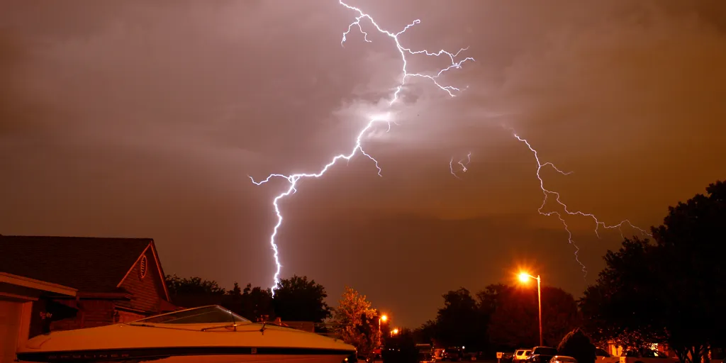
- Tornadoes: Atmospheric conditions are ripe for tornado formation, meaning residents should be ready to take cover at a moment’s notice if warnings are issued.
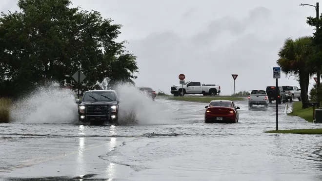
- Flash Flooding: A surge of heavy rain could overwhelm drainage systems, leading to street flooding and road closures.
- Damaging Winds: Wind gusts of 60 mph or higher could topple trees, knock out power lines, and create hazardous conditions for drivers and pedestrians.
Dramatic Temperature Swings – A Wild Weather Ride Ahead
If the rain and wind weren’t enough, temperatures will swing wildly over the next few days, adding another layer of unpredictability.
- Tuesday, March 4: A relatively mild day with highs around 59°F (15°C) and lows near 50°F (10°C).
- Wednesday, March 5: The storm hits. Temperatures will peak at 67°F (20°C) before quickly dropping to 44°F (6°C) overnight.
- Thursday, March 6: The storm moves out, but chilly air lingers. Expect highs around 52°F (11°C) and lows plummeting to 32°F (0°C).
This rapid drop in temperatures could make roads slick after the storm, especially in the early morning hours.
How to Stay Safe and Prepare for the Storm
This is not just a regular rainstorm—it has the potential to be dangerous, especially with the risk of tornadoes and strong winds. Here’s what you should do before, during, and after the storm:
- Monitor weather alerts – Keep an eye on trusted weather sources like the National Weather Service or local news for real-time updates and warnings.
- Have a tornado safety plan – If a tornado warning is issued, seek shelter immediately in a basement or an interior room away from windows.
- Prepare for power outages – Charge your phones, flashlights, and backup batteries in case of electrical failures.
- Secure outdoor items – Bring in patio furniture, trash bins, and decorations before the winds pick up.
- Avoid driving in flooded areas – If you see water covering the road, don’t risk it—turn around!
- Dress for the cold after the storm – Once the system moves out, it will feel much colder, so have warm clothes ready.
Final Thoughts
Washington, D.C. is no stranger to unpredictable weather, but this midweek storm could be one of the most intense of the season. With the threat of tornadoes, high winds, and flash flooding, it’s essential to stay informed and take this storm seriously.
If you haven’t already, start preparing now. Charge your devices, have an emergency plan, and be ready to take action if conditions turn dangerous. Stay alert, stay safe, and don’t underestimate this storm—it could be a rough ride for the capital

