
Spring may have officially started, but winter is making a comeback this week. A storm moving through Sioux Falls is bringing a messy mix of rain, snow, and gusty winds, and it’s set to stick around through Wednesday, April 2nd. Whether you’re hoping to enjoy the warmer weather or just need to get out and about, this storm is likely to throw a wrench in your plans. Here’s what you can expect and how to stay safe.
What’s Coming:
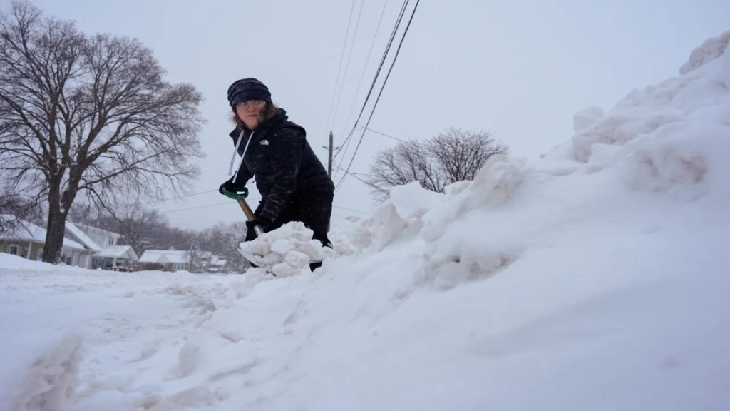
The storm began early Tuesday morning, with light rain showers making the roads slick. But that’s just the start—temperatures are set to drop, and the rain will transition into snow as we move through the day. By the evening, snow will start to accumulate, with 3 to 5 inches expected to fall by the time it clears out Wednesday night. It’s not just the snow that’s going to make things tricky—it’s the wind and the combination of wet, freezing weather that will really create hazards.
The rain will freeze quickly as the temperatures drop, making for slushy, icy roads. And when the snow begins, it will cover that slush, turning sidewalks and streets into slick, snowy obstacles. To make matters worse, winds will pick up, causing blowing snow that can reduce visibility, making it harder to see while driving or walking outside.
Why It’s a Big Deal:
-
Travel Will Be Tough: If you need to be out on the roads, it’s going to be a rough couple of days. The mix of rain and snow will leave the roads slick and icy, and the wind will blow snow across the streets, making visibility poor. As temperatures drop, the wet roads will freeze, turning into patches of ice—especially on bridges and overpasses, which freeze faster than regular roads. If you can stay home, it’s best to do so. If you must go out, make sure your vehicle is ready for winter weather—check your tires, make sure your windshield wipers are working, and always keep your headlights on when driving.
-
Blowing Snow Will Make It Hard to See: The gusty winds won’t just make things cold—they’ll also blow the snow around, creating drifts and reducing visibility to near-zero at times. It’s going to be hard to see while driving, and if you’re on the road during a heavy snow burst, it could feel like a whiteout. If the snow gets intense, it’s best to pull over and wait for the worst of it to pass. Trying to push through dangerous conditions will only put you at risk.
-
It’s Going to Be Cold: Even though it’s April, it’s still going to feel like winter. Temperatures will hover right around freezing, but with the wind chill, it will feel much colder. The snow and wet conditions will make it feel even worse. Make sure to bundle up if you have to go outside—wear a heavy coat, gloves, and a hat to protect your hands, feet, and ears from the cold. If you’re out in it for too long, frostbite can set in, so limit your time outside as much as possible.
How to Stay Safe:
-
Stay Home If You Can: The best way to stay safe during this storm is to stay indoors. If you don’t have to go anywhere, avoid the roads completely. If you must head out, be prepared for poor driving conditions and slow traffic. Take your time, drive cautiously, and keep plenty of distance between your car and others on the road.
-
Prepare for Power Outages: High winds and snow could cause power outages in the area, so make sure you’re prepared. Keep a flashlight, extra batteries, and blankets on hand in case the lights go out. It’s also a good idea to charge your phone and have a backup power bank in case of emergencies. Stock up on non-perishable food and water just in case the storm leaves you stuck at home longer than expected.
-
Dress Warmly and Protect Yourself: The cold is going to make this storm feel even worse than it is. If you have to venture outside, make sure to layer up to stay warm. Wear a thick coat, insulated gloves, a scarf, and a hat to keep yourself protected. Be mindful of exposed skin—frostbite can set in quickly when the wind chill is this low. The less time you spend outside, the better.
-
Stay Updated: Keep an eye on the latest weather reports and road conditions so you know what to expect. The storm could change direction or intensity at any moment, so being informed will help you make the right decisions. If you need to adjust your plans, it’s better to do it sooner rather than later.
Why Is This Happening?
This storm is being caused by a low-pressure system moving through the central part of the country. As it moves over South Dakota, it’s pulling in moisture from the atmosphere, which is turning into rain and snow as the temperature drops. The winds are picking up and blowing that snow across the roads, which is only going to make things worse for travelers. This storm isn’t expected to last too long—it should clear up by Wednesday evening, but not before it leaves behind several inches of snow and potentially icy conditions.
For those in Sioux Falls, today and tomorrow are shaping up to be challenging weather days. Snow, rain, and wind will make the roads slippery and potentially hazardous. If you don’t have to travel, stay inside and enjoy the cozy indoor weather. If you must go out, be prepared for difficult conditions and take it slow. Stay safe, stay warm, and keep an eye on the forecast as the storm progresses. Remember—winter may be sticking around for just a little longer, but soon enough, we’ll be able to put it behind us.

