
Hey, Calgary! Looks like we’re in for a chilly Saturday night. Snow is on the way, and it’s bringing a serious wind chill with it. Temperatures will drop to -4°C, but with wind gusts reaching up to 40 km/h, it’s going to feel more like -11°C. So, if you’ve got plans to be out and about, you might want to rethink that and bundle up. Here’s what you need to know so you can stay safe and cozy.
What’s Coming: Snow, Wind, and a Cold Snap
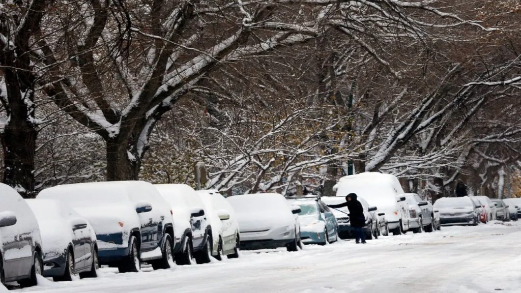
The snow is expected to start falling in the afternoon and will continue well into the night. It won’t be a huge snowstorm, but enough to cover the roads and make everything slippery. With the snow comes the wind, which will kick up in the late afternoon and get stronger as the evening progresses. That’s when things will start to feel really cold. Even though the thermometer may read -4°C, the wind chill will make it feel more like -11°C, and that bite in the air is going to hit you as soon as you step outside.
Who’s Affected: Calgary and Surrounding Areas
Calgary will get the brunt of the snow and wind, but don’t think you’re safe if you’re outside the city. Snow and cold gusts will spread out through surrounding areas too. If you’re in the city, it’s best to stay off the roads if you can. Snow-covered streets, combined with strong winds and low visibility, make travel a real challenge. And if you have to drive, make sure you’re extra cautious and allow plenty of extra time to get where you need to go.
Key Things to Know:
-
Snowfall: The snow will start falling Saturday afternoon and continue through the night. It won’t be a ton of snow, but enough to create slick roads and poor visibility, especially in the evening and overnight.
-
Wind Chill: Winds will make it feel much colder than it actually is. Expect a wind chill that’ll make it feel like -11°C by nightfall. If you’re heading out, it’s going to be pretty uncomfortable with that sharp, biting wind.
-
Travel: If you don’t have to be out driving, it’s best to stay home and avoid the roads. If you do need to head out, make sure your vehicle is ready for winter—check your tires, wipers, and have an emergency kit in the car just in case. And, if you’re on the roads, slow down and keep your distance from other vehicles.
-
Timing: The snow will start around Saturday afternoon, but the worst of it will be in the evening and overnight when the wind kicks in. That’s when it’s going to feel the coldest, so be prepared.
How to Stay Warm and Safe:
-
Bundle Up: If you need to go outside, layers are key. Put on your warmest jacket, a hat, gloves, and a scarf to keep the cold wind off your face. Trust us, you’ll want to cover every inch of skin if you’re heading out into that wind chill.
-
Drive Safely: If you absolutely must drive, make sure your car is winter-ready. That means checking your tires, topping off windshield wiper fluid, and having some winter essentials—like blankets, snacks, and a flashlight—just in case you get stuck.
-
Stay Inside If You Can: If you don’t need to go out, stay cozy at home. It’s the best place to be when the weather’s this cold. A warm drink, a comfy blanket, and a good movie sound like the perfect way to ride out this snowstorm.
What Else to Watch Out For:
Even though the snow won’t be heavy, we’re still looking at some potential issues. Accumulating snow can lead to slippery roads, and if the wind is strong enough, it could cause tree branches to snap and power outages in some areas. If you live in a place with lots of trees, it’s always a good idea to check your outdoor areas for anything that could blow around or get damaged. And if you lose power, make sure you’ve got some backup heat and lights ready.
Get Ready for a Chilly Night Ahead
Saturday night is shaping up to be cold and snowy, so it’s a good idea to plan ahead. Snow and wind will make the roads slick, and the wind chill will make it feel much colder than it is, especially if you’re heading outside. Whether you’re running errands or just want to go for a walk, be sure to bundle up and stay safe.

