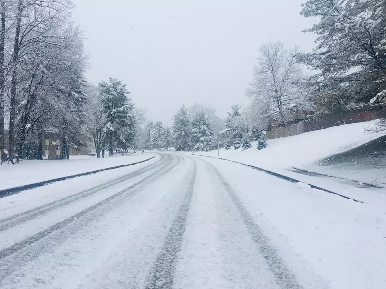
Idaho, winter is back with a vengeance! A powerful storm is rolling in, bringing up to 20 inches of snow in higher elevations, strong winds, and seriously dangerous road conditions. If you have travel plans over the next couple of days, you might want to reconsider—this storm is going to make a mess of things.
The National Weather Service has issued a Winter Storm Warning for parts of southern Idaho, and if you live in the mountains, get ready for a serious dump of snow. Lower elevations won’t escape either—what starts as rain will quickly turn into snow, making roads slick and visibility poor.
Who’s Getting the Worst of It?
This storm will hit hardest in:
Bear River Range
Franklin & Eastern Oneida Region
Marsh & Arbon Highlands
Raft River Region
Southern Hills & Albion Mountains
If you’re in or driving through these areas, expect deep snow, near-whiteout conditions, and possible road closures.
How Much Snow?
- Below 6,000 feet: 2 to 6 inches—enough to make driving a headache.
- Above 6,000 feet: 10 to 20 inches—full-on winter wonderland, but also a travel nightmare.
When will the snow hit?
- Starts Wednesday afternoon—lower elevations could see rain at first, but it’ll turn to snow as temperatures drop.
- Heaviest snowfall Wednesday night through Thursday—this is when roads will be at their worst.
Strong Winds Will Make It Even Worse
As if the snow wasn’t enough, gusty winds up to 30 mph will create blowing and drifting snow, making things even more dangerous.
Visibility will be awful—driving in open areas could mean whiteout conditions.
Snowdrifts will pile up fast, making some roads hard to navigate.
Icy spots and slick roads—especially on bridges and overpasses.
Travel Will Be a Challenge—Here’s What You Need to Know
If you must drive, be prepared for:
Treacherous mountain passes—deep snow, ice, and possible chain requirements.
Slow-moving traffic—expect major delays on highways and in high-elevation areas.
Slick roads everywhere—even in town, the rain-snow mix will make things slippery.
Check road conditions before heading out! Visit 511.idaho.gov or call 511 for updates.
How to Stay Safe During the Storm
Avoid driving if you can. If you don’t have to be on the road, stay home and stay warm.
Stock up on essentials. If you live in a mountain town, grab groceries, batteries, and firewood before things get bad.
Be ready for power outages. Heavy snow and wind could take down power lines.
Keep an emergency kit in your car. If you must drive, bring food, water, blankets, a flashlight, and extra batteries.
When Will It End?
The storm should wind down by Friday evening, and by the weekend, things will start to clear up. But until then, expect full-on winter conditions across Idaho!
This isn’t just a light dusting—it’s a full-fledged winter storm with heavy snow, dangerous winds, and icy roads. If you’re in or near the mountains, stay put if possible and be prepared for some intense winter weather.


