
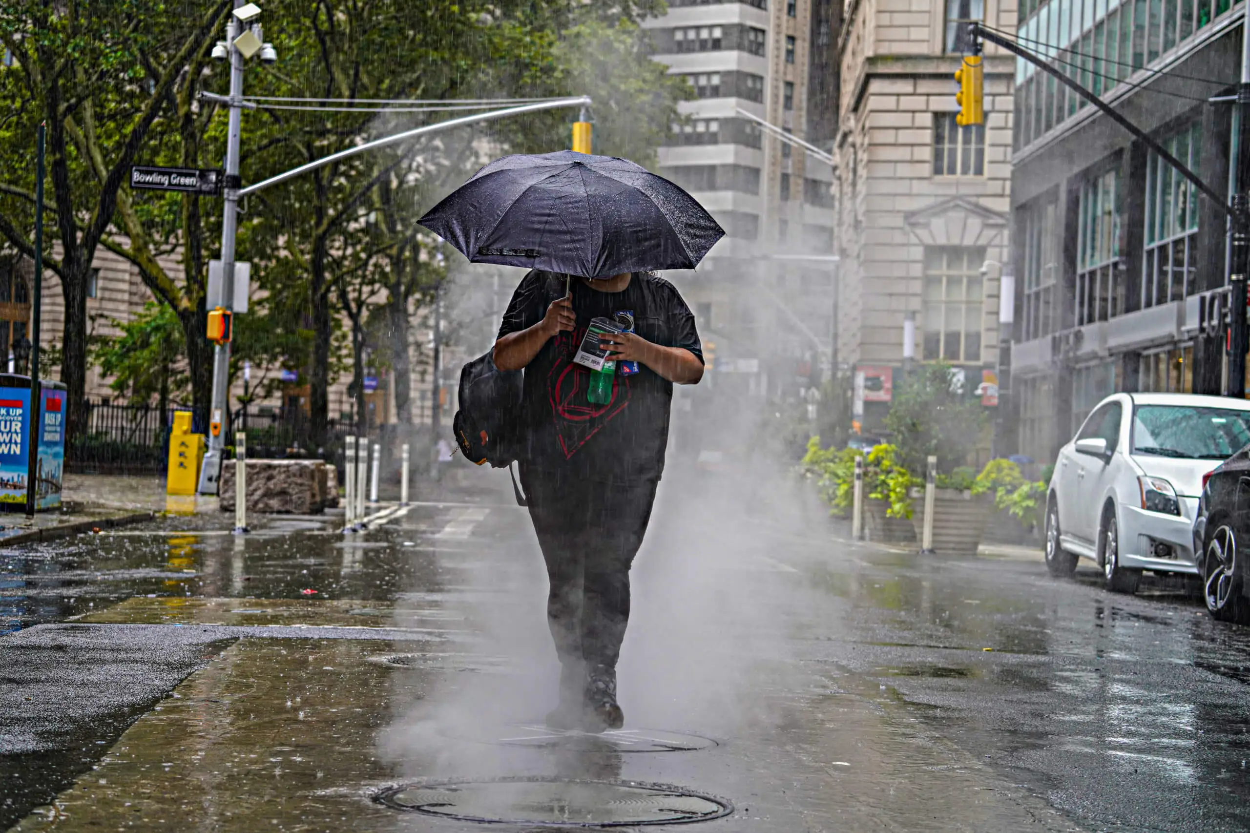
New Yorkers, brace yourselves for a wild and messy Thursday as a powerful storm system barrels into the region, bringing heavy rain, howling winds, and potential travel chaos. If you were hoping for a smooth end to the workweek, think again—this storm could drench the city with over an inch of rain and unleash wind gusts strong enough to knock down trees and power lines. Whether you’re commuting, running errands, or just stepping out for a coffee—expect to get soaked
What’s Coming: A Wet and Windy Mess
A storm system moving up the East Coast is set to slam into New York early Thursday morning, unleashing a relentless downpour and powerful wind gusts that could reach 40 mph or higher. The heaviest rain is expected between the morning and early afternoon, tapering off by the evening. But don’t let that fool you—the damage may already be done by then.
-
Rainfall Totals: Expect between 0.75 and 1.5 inches of rain, with heavier pockets possible. Low-lying and flood-prone areas could see localized flooding, making some roads and subway entrances difficult to navigate.
-
Winds That Pack a Punch: Gusts up to 40 mph could send debris flying, knock down tree limbs, and cause power outages. Pedestrians, especially those crossing bridges or walking through wind tunnels created by skyscrapers, should prepare for some serious gusts.
-
Travel Troubles: Morning commuters should expect reduced visibility, slick roads, and possible delays on highways and public transit. If you can work from home, Thursday might be the day to do it.
How to Prepare for the Storm
Secure Loose Items: If you have outdoor furniture, trash bins, or decorations, bring them inside or tie them down—strong winds could send them flying.
Drive Carefully: Roads will be slick and hazardous, and hydroplaning is a real danger. If you’re driving, slow down and leave extra space between you and the car ahead.
Prepare for Power Outages: With strong gusts expected, there’s a risk of downed power lines. Keep flashlights and backup chargers handy just in case.
Watch for Flooding: If you live in a flood-prone area, keep an eye on drainage systems and avoid walking or driving through flooded streets.
The Weekend Forecast: A Sharp Cool-Down Ahead
Once this storm moves out, a cold front will sweep through, bringing crisp, cooler air just in time for the weekend.
- Friday: Breezy with sunshine, High: 50°F (10°C), Low: 37°F (3°C)
- Saturday: Partly cloudy and even cooler, High: 48°F (9°C), Low: 32°F (0°C)
Bottom Line: Be Ready for a Rough Thursday!
This storm is not one to ignore—expect torrential rain, strong winds, and a messy commute. Take precautions, stay updated on the latest weather alerts, and plan for a soaking-wet start to the day. After the storm passes, a much-needed cooler and calmer weekend awaits. Stay safe, New York.

