
Los Angeles is about to experience a major weather shake-up, and it could catch many by surprise! If you’ve been enjoying the warm, sunny days, brace yourself—because a powerful storm system is heading straight for Southern California. Starting midweek, the city will face heavy rain, potential thunderstorms, and dangerously high surf, creating hazardous conditions both on land and along the coast. If you haven’t checked the forecast yet, now’s the time—this storm could bring flooding, power outages, and travel disruptions across the region. Here’s what you need to know to stay safe and prepared.
When Will the Storm Arrive?
Forecasters predict that the storm will move into Los Angeles on Wednesday, March 5, bringing steady rainfall throughout the day. The heaviest downpours are expected in the afternoon and evening hours, making the commute a messy and potentially dangerous one. Drivers should be prepared for slippery roads, reduced visibility, and possible road closures in flood-prone areas.
Rainfall totals could vary across the region, but parts of Los Angeles County may see up to an inch of rain or more, especially in the foothills and mountain areas. Low-lying neighborhoods and streets with poor drainage could experience localized flooding, so residents should stay alert and avoid driving through standing water.
Thunderstorms & High Winds Could Bring More Trouble
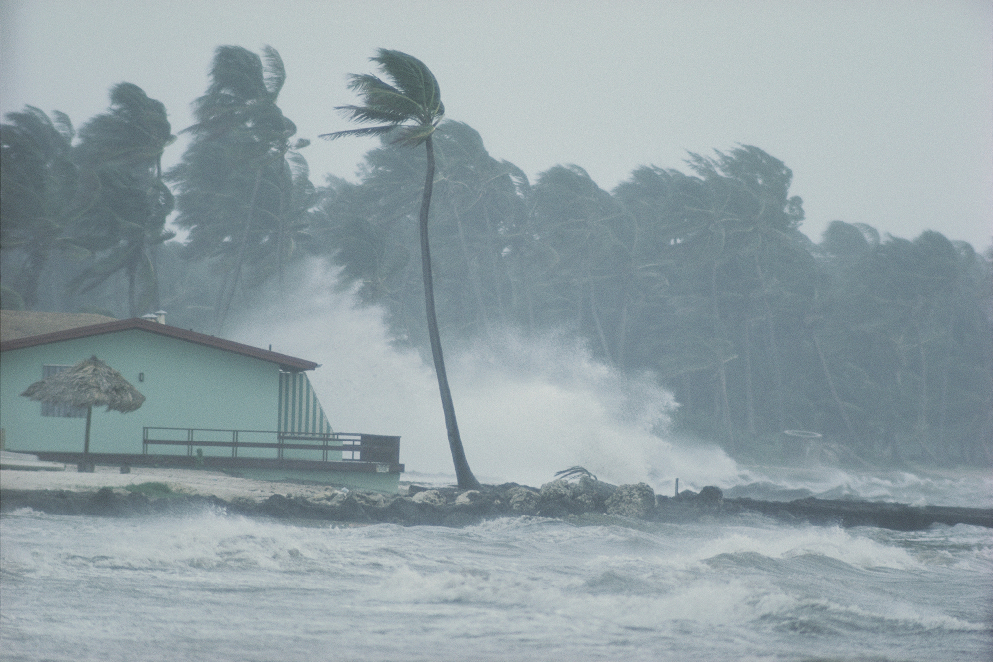
This isn’t just a simple rainstorm—thunderstorms could develop across Southern California, bringing strong winds, lightning, and bursts of intense rainfall. Gusty winds could reach up to 40 mph, increasing the risk of falling branches, power outages, and flying debris.
The National Weather Service is also watching for sudden, intense downpours, which could create flash flooding, especially in areas with burn scars from previous wildfires. If you live near canyons or steep hillsides, stay extra cautious—mudslides and debris flows are possible in vulnerable areas.
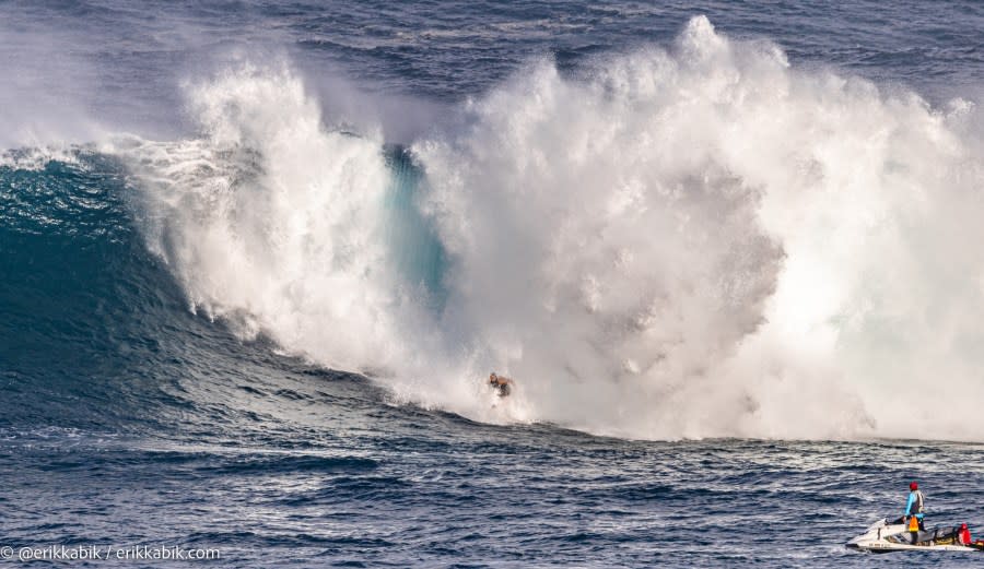
Coastal Danger: High Surf and Life-Threatening Rip Currents
If you were planning a beach day this week, think again. This storm is churning up the Pacific Ocean, creating extremely dangerous surf conditions along the California coastline. Forecasters are warning that waves could reach 10-15 feet high, with rip currents strong enough to pull even the strongest swimmers out to sea.
Beachgoers, surfers, and boaters are being urged to stay out of the water—even experienced surfers should think twice before heading out. These conditions could last several days, so if you’re near the coast, keep an eye on official warnings and avoid standing too close to the water’s edge.
Big Temperature Drop Coming – Get Your Jackets Ready!
If the recent warm weather made you think winter was over, think again. Temperatures will take a sharp dip as the storm moves through.
- Tuesday, March 4: Highs in the mid-60s°F (18°C), but clouds begin to roll in.
- Wednesday, March 5: Rain and wind dominate, with highs struggling to reach 58°F (14°C). Overnight lows will drop to mid-40s°F (7°C).
- Thursday, March 6: Storm moves out, but cool air lingers. Highs near 59°F (15°C), with chilly nights around 42°F (5°C).
It won’t be freezing, but the combination of wind and rain will make it feel even colder—so pull out those warmer layers, raincoats, and boots before heading out.
How to Stay Safe and Prepare for the Storm
This storm isn’t expected to be a historic disaster, but it will be disruptive. Here’s how you can stay safe and avoid getting caught off guard:
- Avoid driving in flooded areas – Even a few inches of water can make roads dangerous. Turn around, don’t drown!
- Prepare for power outages – Charge your phones, have flashlights ready, and keep extra batteries handy.
- Secure loose outdoor items – Winds could be strong enough to send patio furniture, trash bins, and decorations flying.
- Stay off the beaches and ocean piers – High surf and rip currents could be deadly. Watch from a safe distance if you must.
- Layer up and stay dry – Wind-driven rain will make it feel colder than it is, so dress appropriately.
Final Thoughts
Los Angeles is no stranger to wild weather shifts, but this midweek storm will be a wake-up call after weeks of calm skies. With heavy rain, gusty winds, the risk of thunderstorms, and extremely dangerous surf, this isn’t a storm to take lightly.
If you’re out and about on Wednesday, stay aware, be prepared, and don’t take unnecessary risks—especially on the roads or near the ocean. Stay safe, L.A.—this storm means business

