
St. Louis is on high alert as a powerful storm system barrels toward the region, bringing the risk of tornadoes, destructive winds, and heavy rain. The National Weather Service has issued multiple weather advisories, including a Wind Advisory and a Winter Weather Advisory, signaling the seriousness of this incoming storm. With gusts over 60 mph capable of bringing down trees and power lines, and isolated tornadoes possible, residents need to prepare now before it’s too late.
What’s Happening?
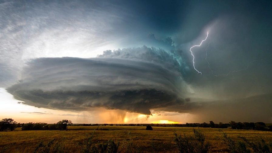
A fast-moving storm system is sweeping through the Midwest, and St. Louis is directly in its crosshairs. Forecasters warn that the most dangerous conditions will develop overnight Tuesday into early Wednesday morning. The storm’s powerful winds, intense downpours, and unstable air create a perfect recipe for severe thunderstorms and possible tornadoes.
The biggest threats include:
- Damaging Winds: Gusts exceeding 60 mph could knock down trees, power lines, and unsecured outdoor objects.
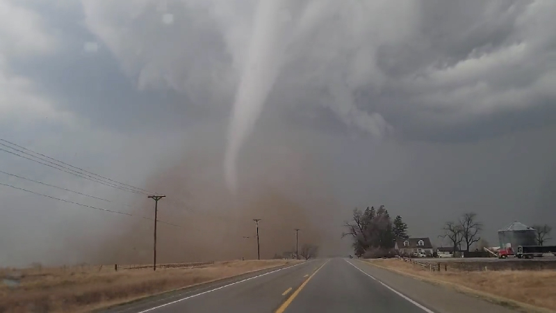
- Tornado Risk: While not guaranteed, conditions favor tornado formation, meaning residents must be ready to take shelter at a moment’s notice.
- Heavy Rain & Flash Flooding: Rapid rainfall could overwhelm drainage systems, causing localized flooding in low-lying areas.
- Sudden Temperature Drop: After the storms pass, temperatures will plummet, bringing a dramatic shift from thunderstorms to cold, breezy conditions.
When Will the Storm Hit?
- Tuesday Night (March 4): Expect breezy conditions with increasing clouds throughout the evening. Severe thunderstorms could develop late at night, bringing heavy rain and damaging winds. Highs will reach 69°F (20°C) before cooling to 56°F (13°C) overnight.
- Wednesday Morning (March 5): The most dangerous part of the storm will peak early, with strong winds, thunderstorms, and tornado potential. As the system moves out, expect cooler, breezy conditions with a daytime high of 64°F (18°C), dropping to 37°F (3°C) by night.
How Will This Impact St. Louis?
- Tornado Threat: If conditions become more unstable, tornadoes could quickly form. If a tornado warning is issued, seek shelter immediately in an interior room away from windows.
- Power Outages Expected: High winds could bring down power lines, leaving homes in the dark. Charge your phones and backup batteries before the storm hits.
- Flooding Risk: The intense rainfall could overwhelm storm drains, causing flash flooding in flood-prone areas. Never attempt to drive through standing water—it’s deeper and stronger than it looks!
- Treacherous Travel Conditions: Morning commutes could be dangerous with wet roads, low visibility, and powerful wind gusts. Drivers should avoid unnecessary travel.
How to Stay Safe During the Storm
- Stay Weather-Aware: Monitor weather alerts on your phone, TV, or radio to get updates in real-time. Tornadoes can form with little warning!
- Secure Loose Items: Bring in outdoor furniture, trash bins, and decorations that could become airborne in strong winds.
- Prepare for Power Outages: Keep flashlights, extra batteries, and non-perishable food on hand in case the storm knocks out electricity.
- Know Your Safe Zone: The safest place during a tornado is a basement or interior room with no windows. Make sure all family members know where to go.
- Avoid Flooded Roads: Just a few inches of water can sweep away a car. If you see standing water, turn around—don’t risk it!
When Will the Weather Improve?
The storm system will begin moving out of St. Louis by Wednesday afternoon, leaving behind cooler, breezy conditions. However, clean-up efforts and power restoration may take time, so residents should stay cautious even after the storm passes.
This is one of the strongest storm threats of the season, and it’s crucial for residents to stay prepared, stay informed, and take action now. Don’t take this storm lightly—your safety depends on it

