
Spring in Nevada sure likes to keep us on our toes! Just when you thought it was time to pack away the winter coats, Mother Nature has other plans. A cold front is moving in on Wednesday night, bringing a mix of rain, chilly winds, and possibly even some snow—yes, in April!
If you’re planning to be out and about Wednesday evening or have an early commute on Thursday, here’s what you need to know so you’re not caught off guard.
So… Rain or Snow? What’s Actually Coming?
The answer? A little bit of both. This system is bringing rain first, but as temperatures drop, we could see some of that rain turn into snow overnight. Here’s how it’s likely to play out:
- Rain will start falling in the evening as temperatures hover just above freezing.
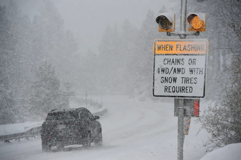
- As the night goes on, colder air will move in, meaning some areas—especially higher elevations and west of Reno—could see snow mixing in with the rain.
- Snow accumulation? Probably not much in the lower parts of Reno, but in the foothills or on the passes, you could wake up to a light dusting Thursday morning.
- Wind gusts up to 25 MPH will make it feel even colder, so don’t be fooled by the calendar—it’s going to feel more like February than April!
How This Might Affect Your Evening Plans
While we’re not expecting a full-blown winter storm, this mix of rain, snow, and wind could create some issues if you’re out late or driving early Thursday morning. Here’s what to keep in mind:
- Roads could get slick – If temperatures drop lower than expected, wet roads could turn icy in spots—especially on bridges, overpasses, and shady areas. If you’re driving late at night or early in the morning, take it slow.
- It’s going to feel cold! – With the wind and damp conditions, it’ll feel much colder than the actual temperature. If you’re stepping out Wednesday night, bring a jacket and maybe even a hat and gloves—yes, really!
- Snow in the mountains – If you’re heading into the foothills or toward Donner Pass, expect a much higher chance of snow sticking. Chain controls are possible, so check road conditions before heading up.
What You Can Do to Prepare
Even though this isn’t a major storm, it’s still worth taking a few precautions so you don’t get caught off guard:
- Check road conditions before heading out, especially if you’re traveling late or heading into higher elevations.
- Dress in layers – It might feel like spring during the day, but once that wind and moisture hit, it’s going to feel much colder.
- Plan for a wet Thursday morning – Whether it’s rain or slushy leftovers from snow, the roads could be slick for the morning commute, so give yourself extra time.
What Happens After This?
The good news? This storm will move out quickly. By Thursday afternoon, things should dry out, but it will stay a little cooler than usual for the next couple of days. Then, as we move toward the weekend, we’ll be back to warmer spring weather (hopefully for good this time!).
Welcome to Spring in Nevada!
Spring in Nevada is always a bit unpredictable, and this storm is just another reminder that we’re not out of the woods yet when it comes to cold weather.
So, if you’re heading out Wednesday night, grab a jacket, watch out for slick roads, and keep an eye on the skies—because in Reno, you never know if you’ll be walking through sunshine, rain, or even a little surprise snow! Stay warm and stay safe!

