
Orlando, this is not just another rainy day! A dangerous storm system is set to unleash tornadoes, severe thunderstorms, and flooding rains across Central Florida in the next 24 hours. If you thought Florida’s storm season was still months away, think again—this system has the potential to cause widespread damage, knock out power, and turn roads into rivers. The National Weather Service has warned that conditions are ripe for destructive winds, torrential rainfall, and isolated tornadoes, which means every resident needs to be on high alert.
Orlando Braces for Severe Storms – Here’s What You Need to Know
Weather experts are tracking a powerful system that is expected to move into Central Florida Wednesday evening into Thursday morning. This storm will bring multiple threats, including:
- Damaging Winds – Gusts could exceed 58 mph, toppling trees, knocking down power lines, and causing flying debris hazards.
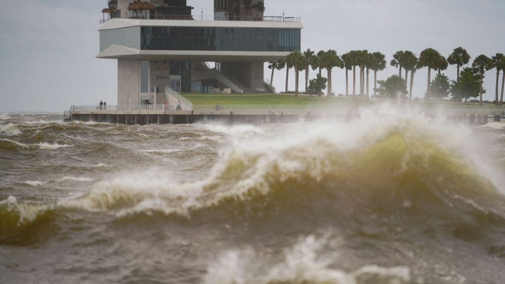
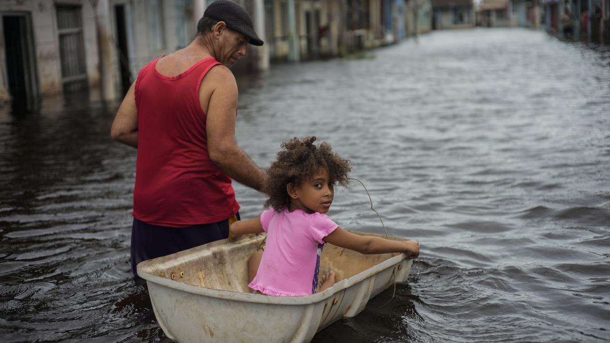
- Flash Flooding – Several inches of rain could overwhelm drainage systems, flooding low-lying areas and roads.
- Tornado Threat – Warm, unstable air creates the perfect setup for tornadoes to develop, especially in areas just south of Orlando.
- Severe Thunderstorms – Expect intense lightning, booming thunder, and possible hailstones.
- Dangerous Road Conditions – Rain and wind will make driving extremely hazardous, with low visibility and ponding on highways.
Authorities are urging residents to prepare now before conditions deteriorate. If a tornado warning is issued, take cover immediately!
How Much Rain and Wind Will Orlando Get?
- Rainfall Amounts:
- Coastal and inland areas could see 2 to 4 inches of rain, with higher totals possible in isolated thunderstorms.
- Temperature Swings:
Daytime highs will remain warm at 77°F, but once the storm moves through, temperatures will dip to a chilly 60°F overnight. - Wind Gusts:
Expect wind speeds between 40-60 mph, strong enough to bring down tree branches and power lines, causing potential blackouts.
Major Dangers: Why This Storm Is Different
- TREACHEROUS TRAVEL CONDITIONS – Roads could quickly flood, creating dangerous situations for commuters.
- POWER OUTAGES LIKELY – Downed trees and power lines could leave thousands in the dark.
- FLOODING THREAT – Some areas, particularly near lakes, rivers, and low-lying neighborhoods, could see significant flooding.
- TORNADOES POSSIBLE – While not guaranteed, the right ingredients for tornado development are present in this system.
- PROPERTY DAMAGE RISK – Roof damage, broken windows, and flooding are all possible if winds strengthen.
How to Stay Safe During Orlando’s Severe Weather Event
- Prepare for Flooding – Move valuables to higher ground, avoid flood-prone streets, and never drive through standing water!
- Secure Outdoor Items – Bring in patio furniture, umbrellas, and trash cans before the wind sends them flying.
- Charge Your Devices – With power outages possible, make sure phones, flashlights, and backup batteries are fully charged.
- Stay Indoors When Storms Hit – If conditions worsen, stay away from windows and avoid unnecessary travel.
- Have an Emergency Plan – Know where to take cover in case a tornado forms, and have a storm kit ready with essential supplies.
Final Thoughts: Orlando’s Weather Is About to Get Wild!
Orlando is no stranger to storms, but this one is packing a serious punch. With the threat of tornadoes, damaging winds, and flooding rains, it’s crucial that everyone stays informed and takes this system seriously. Don’t assume it’s just another passing storm—this one could cause major problems if you’re not prepared.
Storms this intense can develop quickly, so keep an eye on alerts, take precautions, and stay safe. This could be one of the most significant weather events Orlando has seen in months, so don’t take it lightly.

