

New Orleans is gearing up for a drastic weather shift as a storm system moves in, bringing heavy rains, gusty winds, and the threat of localized flooding. The calm and mild conditions the city has enjoyed in recent days will quickly turn into a soaking mess by Sunday, potentially disrupting weekend plans and travel.
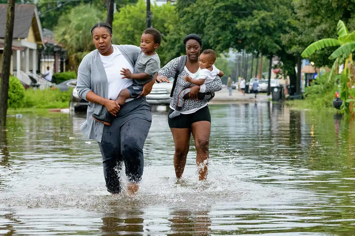
Meteorologists are warning that low-lying areas and poor drainage spots could experience flooding, with some neighborhoods seeing several inches of rainfall in a short period. If you’re heading out, expect wet roads, slower commutes, and the possibility of street closures in flood-prone zones.
Current Conditions: The Calm Before the Storm
New Orleans is waking up to cloudy skies and cool temperatures around 46°F (8°C). While today will stay mostly dry, a few stray showers can’t be ruled out, especially in the afternoon. The real trouble, however, begins Sunday, when steady rain moves in, setting the stage for a wet and stormy start to the new week.
Weekend Forecast: A Major Shift in the Weather Pattern
The weekend will bring a stark contrast to the dry conditions New Orleans has enjoyed recently.
- Saturday: Mostly cloudy and cool, with highs reaching 56°F (13°C). A few light showers are possible, but nothing major—yet.
- Sunday: The real storm arrives. A strong system will bring periods of heavy rain and gusty winds, making for a soggy and potentially hazardous day. High temperatures will stay around 54°F (12°C), while nighttime lows drop to 46°F (8°C).
Next Week: A Quick Turn Back to Sunshine
The good news? Once the storm moves out, New Orleans will see a significant warm-up and dry conditions for most of next week.
- Monday: The rain clears out, and sunshine returns! Expect a pleasant high of 64°F (18°C).
- Tuesday: A big warm-up, with temperatures soaring to 74°F (23°C). A perfect day for outdoor activities.
- Wednesday: Even warmer, as highs reach 78°F (26°C) with plenty of sunshine.
- Thursday: A slight cooldown, but still comfortable, with a high of 71°F (22°C).
- Friday: Mostly sunny, with a high of 68°F (20°C), wrapping up the week on a mild and dry note.
Why Is New Orleans Getting So Much Rain?
This weekend’s storm is being fueled by moisture from the Gulf of Mexico, which is pushing into the region ahead of a cold front. As warm, humid air collides with cooler temperatures, it creates the perfect conditions for heavy downpours.
New Orleans is especially vulnerable to flooding due to its low elevation, and with several inches of rain expected in a short period, storm drains could quickly become overwhelmed. If you live in an area prone to flooding, be prepared to take action if water levels rise.
How to Stay Safe in This Weekend’s Storm
- Watch for Flash Flooding: If you see standing water, turn around—don’t drive through it! Just a few inches of water can stall a car or sweep it away.
- Secure Loose Items: Gusty winds could knock down patio furniture, decorations, or trash bins. Bring them inside if possible.
- Be Cautious on the Roads: Wet streets and poor visibility could lead to dangerous driving conditions. Slow down, use headlights, and allow extra time for travel.
- Stay Updated on Alerts: Weather conditions can change fast. Keep an eye on official forecasts and emergency updates throughout the weekend.
- Prepare for Possible Power Outages: With strong winds and heavy rain, downed power lines are possible. Charge your devices and keep flashlights handy.
Bottom Line: A Soggy Weekend, But a Sunny Week Ahead
New Orleans is in for a wet and stormy weekend, but the good news is that sunshine and warm temperatures will return quickly after the rain clears.
If you’re planning to be out and about, be prepared for wet roads, potential flooding, and delays. But once we get past this rainstorm, next week will bring perfect conditions for enjoying the outdoors.

