
Jacksonville, get ready—because the weather is about to turn dangerous. While things may seem calm now, a powerful storm system is gearing up to unleash tornadoes, flash floods, and howling winds across the region by midweek. Forecasters are warning that this is not a storm to take lightly. If you haven’t prepped your home and emergency kit, now is the time!
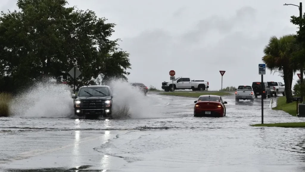
This intense system is expected to bring severe thunderstorms with torrential rain, strong wind gusts, and the risk of tornadoes. Some areas may see dangerous flash flooding, power outages, and downed trees. The worst of the weather is expected to hit late Wednesday, making travel treacherous and leaving parts of the city at risk of significant storm damage.
Current Conditions: The Calm Before the Storm
As of this morning, Jacksonville is experiencing clear skies and mild temperatures around 52°F (11°C). But don’t be fooled—this is just a temporary break before things get much worse. Monday and Tuesday will feel pleasant, but by Wednesday, the entire region will be in for a brutal weather shift.
Jacksonville’s Weather Breakdown – What to Expect & When
- Monday, March 3: Enjoy partly sunny skies with highs reaching 67°F (19°C). The night will be cool and quiet, with lows around 49°F (10°C).
- Tuesday, March 4: A beautiful day overall, with mild breezes, partial sunshine, and highs near 75°F (24°C). The night will be a bit warmer, with temperatures holding around 63°F (17°C).
- Wednesday, March 5: Everything changes. The winds pick up, skies darken, and heavy rain moves in. Expect strong thunderstorms, possible tornadoes, and heavy flooding. Temperatures will peak at 79°F (26°C), but the storm will bring wind gusts powerful enough to cause damage.
- Wednesday Night: The storm intensifies, with flash floods likely in some areas. Winds will be strong enough to knock down trees and power lines, causing widespread outages. Lows will drop to 53°F (12°C).
- Thursday, March 6: As the system moves out, cooler, drier air settles in. Expect a breezy, sunny day with highs around 72°F (22°C) and lows dipping to 45°F (7°C).
- Friday, March 7: A return to normal, with partly sunny skies and temperatures near 77°F (25°C).

How to Prepare & Stay Safe During the Storm
- Have a Tornado Safety Plan: Know where to go in case a tornado warning is issued. Basements, interior rooms, and storm shelters are the safest places to be.
- Prepare for Power Outages: Charge all electronics, gather flashlights, batteries, and emergency supplies.
- Stay Away from Flooded Areas: Flash floods can be life-threatening. Never drive through flooded roads—it only takes a few inches of water to sweep a car away.
- Secure Outdoor Items: High winds can turn patio furniture, decorations, and trash bins into dangerous projectiles. Bring them inside or tie them down.
- Avoid Travel During the Storm: If possible, stay home once the severe weather begins. Roads may become dangerous or impassable due to flooding and debris.
What’s Next?
Once the storm moves through, Jacksonville will experience cooler, drier weather for the rest of the week. But before we get there, residents must take this storm seriously. This system has the potential to cause significant damage, especially if tornadoes develop.
Final Warning
This is not just another rainy day. Jacksonville is facing a serious severe weather threat, and residents should be prepared for the worst. Make sure your emergency kit is ready, stay tuned to weather updates, and take action if warnings are issued. Stay safe, Jacksonville—this could be a rough one

