
Fort Worth residents, buckle up for a wild and dangerous weather ride! A powerful storm system is headed straight for North Texas, bringing with it the risk of tornadoes, massive hail, and damaging winds. If you haven’t prepared yet, now is the time!
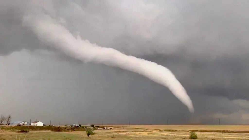
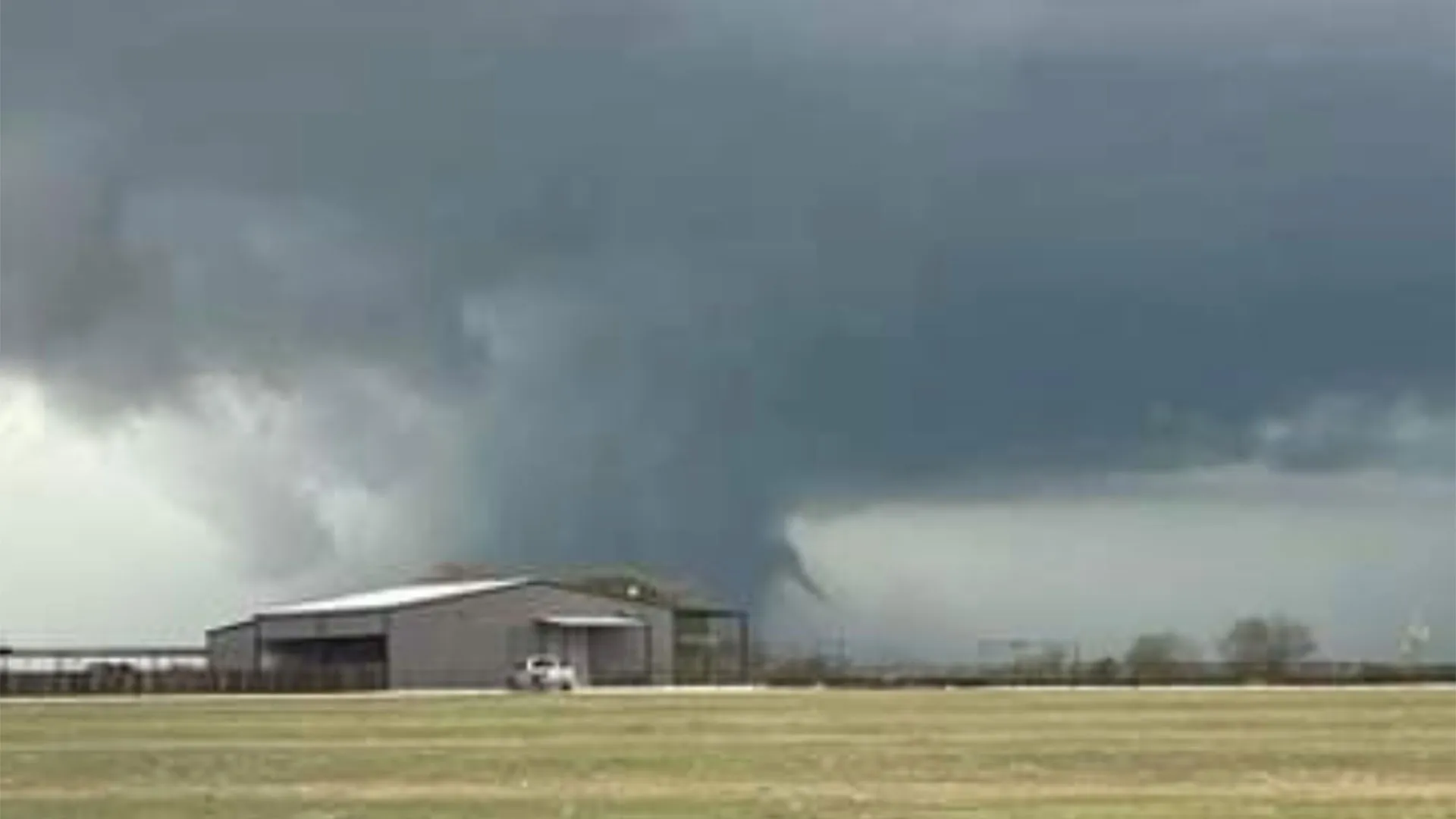
Forecasters are warning that these storms could turn violent late Monday into Tuesday, with some areas seeing hail the size of golf balls or even larger! Strong winds could snap power lines, knock down trees, and cause structural damage, while the possibility of tornadoes adds another level of danger. Flooding could also become an issue as heavy rain moves in, creating dangerous travel conditions.
What’s Happening Right Now?
As of Monday morning, Fort Worth is still relatively calm, with cloudy skies and temperatures hovering around 59°F (15°C). However, don’t be fooled—this is the calm before the storm!
By late Monday night, things will take a dramatic turn. Meteorologists say a major storm system is moving in, and it will bring violent thunderstorms, strong winds, and the potential for severe weather outbreaks.
What to Expect & When
- Monday Afternoon: The sun may peek through the clouds, but temperatures will remain warm, reaching 77°F (25°C). Winds will start picking up, signaling the incoming storm.
- Monday Night: Severe thunderstorms will develop, with a high likelihood of large hail, damaging winds, and possibly tornadoes. The worst of the storms is expected between midnight and early Tuesday morning.
- Tuesday Morning: The severe threat will begin to shift, but heavy rain and thunderstorms could still create flooding risks. Winds will also remain strong. Highs will reach around 73°F (23°C), but temperatures will start to drop as the cold front moves in.
- Tuesday Night: Storms will gradually clear out, but cooler air settles in, with lows dropping to 46°F (8°C).
- Wednesday: A welcome relief—sunny skies return, and the weather stabilizes, though it will be much cooler with highs near 64°F (18°C).
How to Stay Safe During the Storm
- Tornado Preparedness: Have a safe place ready—whether it’s a basement, storm shelter, or an interior room with no windows. If a tornado warning is issued, take cover immediately!
- Hail Protection: Park your car in a garage or under cover to prevent damage from large hailstones. Stay indoors, away from windows, as hail can shatter glass.
- Secure Outdoor Items: High winds can turn patio furniture, trash cans, and loose objects into dangerous projectiles. Bring them inside or tie them down.
- Avoid Flooded Roads: Never attempt to drive through floodwaters. It only takes a few inches of moving water to sweep a vehicle away. If you see flooding, turn around—don’t drown!
- Power Outage Preparedness: With high winds and severe weather, power outages are likely. Charge your phones, keep flashlights handy, and have extra batteries on hand.
What Happens After the Storm?
Once the storms pass, Fort Worth will experience a noticeable cool-down. Temperatures will drop into the 40s and 50s at night, and Wednesday will bring calmer, sunny skies. The worst of the severe weather will have moved out, but residents should still be prepared for possible damage and cleanup efforts.
Final Warning
This storm system is not one to take lightly. With the potential for destructive winds, huge hail, and tornadoes, it’s critical to stay informed and take precautions. Keep your weather alerts turned on, have a safety plan, and be ready to act fast if conditions turn dangerous.

