
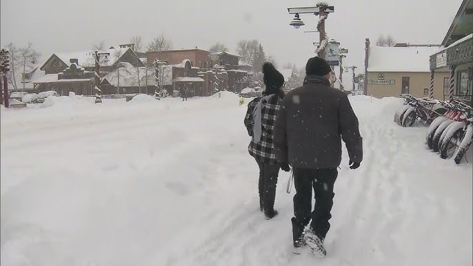
If you’re planning to hit the road this Friday, especially along Interstate 25, you might want to think twice. A major winter storm is on the way, bringing heavy snow, strong winds, and some seriously hazardous driving conditions. This storm is expected to impact key areas along the I-25 corridor, including Denver, Colorado Springs, and Pueblo, making travel a real challenge as we head into the weekend.
What’s the Forecast?
The National Weather Service has issued a Winter Weather Advisory for central Colorado, and here’s what we’re looking at:
- Denver: Cloudy skies with temperatures struggling to get above 38°F (3°C) before dropping to a chilly 25°F (-4°C) overnight. Snow is expected to fall fast and heavy, reducing visibility and making roads slick.
- Colorado Springs: Expect strong winds in the morning, ushering in colder air. Highs will reach around 39°F (4°C) but will plummet to 22°F (-6°C) at night. Low clouds and blowing snow could make driving downright dangerous.
- Pueblo: A slightly warmer start with a high of 46°F (8°C), but temperatures will quickly drop to 26°F (-4°C) by nightfall. Breezy conditions and snow could make for a slippery evening commute.
Why This Storm Is a Big Deal
This isn’t just a light dusting of snow—it’s a serious storm. The mix of heavy snowfall and gusty winds could create whiteout conditions, meaning visibility could drop to nearly zero in some areas. Winds could gust over 40 mph, blowing snow across roads and forming icy patches that are nearly impossible to spot until you’re on top of them.
For truckers, commuters, and anyone traveling this weekend, the message is clear: either drive with extreme caution or reconsider your plans altogether.
Hazardous Roads & Construction Delays
As if the snow and wind weren’t enough, construction-related closures on South Academy Boulevard near US Highway 85/87 are set to begin on Friday, March 7, at 7 p.m. and continue through Monday, March 10, at 4:30 a.m. This could cause additional headaches for drivers already dealing with rough road conditions.
Authorities strongly advise checking real-time road conditions before heading out and keeping an emergency kit in your vehicle. If you must travel, be prepared for slowdowns, detours, and even the possibility of getting stranded.
How to Stay Safe on the Road
If you absolutely have to travel, here are some tips to keep you safe:
✔️ Check your vehicle: Make sure your tires have good tread, your windshield wipers work, and your car battery is strong. ✔️ Pack an emergency kit: Include blankets, snacks, water, a flashlight, and a fully charged phone. ✔️ Drive slow & steady: Speeding on slick roads is a recipe for disaster. ✔️ Watch for black ice: It can form quickly, especially on bridges and shaded areas. ✔️ Stay informed: Keep an eye on weather and road condition updates before heading out.
As this storm moves in, make safety your priority. If you don’t have to go out, stay home. Keep up with weather updates, and don’t underestimate how quickly conditions can go from bad to worse. Colorado’s highways can turn treacherous in an instant, so take this warning seriously.

