

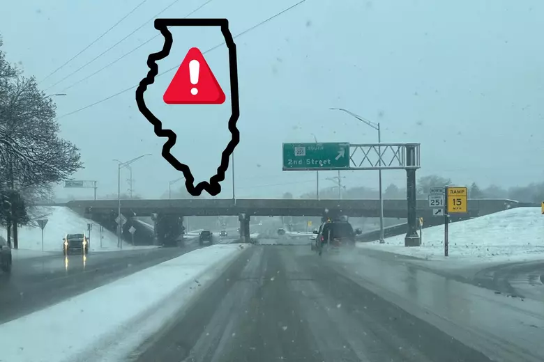
Chicago, brace yourselves—this isn’t just another cold front! A powerful storm system is heading straight for the Windy City, bringing heavy rain, gusty winds, and even snow. If you thought winter was over, think again! This storm will create hazardous road conditions, flight delays, and a brutally cold mix of rain and snow that could impact the entire region.
With temperatures dropping, fierce winds picking up, and precipitation on the way, residents need to prepare for a messy and disruptive few days. Whether you’re commuting, flying, or just trying to stay warm, here’s everything you need to know to stay safe and ahead of the storm.
What’s Happening Right Now?
As of today, Chicago is already experiencing thick cloud cover, with temperatures hovering around 30°F (-1°C). Winds are beginning to pick up, signaling that the storm system is quickly approaching. Meteorologists predict that as the system moves in, rain will arrive first, followed by plummeting temperatures that could turn precipitation into snow.
This storm has the potential to create slick roads, strong wind gusts, and even power outages in some areas. Travelers should be prepared for delays at O’Hare and Midway airports, and drivers should expect poor visibility and wet roads.
Day-by-Day Breakdown: What to Expect This Week
Wednesday, March 6 – Storm Begins, Roads Turn Wet
The first wave of this system will bring cloudy skies and scattered rain showers. The wind will steadily increase throughout the day, making outdoor conditions feel colder.
What to expect Wednesday:
- Rain showers developing by late afternoon, leading to slick roads.
- Temperatures will reach 51°F (10°C) before dropping overnight.
- Winds will pick up, making it feel much colder than the actual temperature.
Thursday, March 7 – Winds Strengthen, Colder Air Moves In
The rain will clear by morning, but temperatures will drop. Expect a breezy day with plenty of sunshine but much colder conditions.
Thursday’s key weather risks:
- Highs will only reach 42°F (6°C), but wind gusts will make it feel even colder.
- Overnight lows will dip to 34°F (1°C), so be ready for a chilly start to Friday.
- Bridges, overpasses, and untreated roads could become icy overnight.
Friday, March 8 – Rain and Snow Mix Could Create a Messy Commute
By Friday, the storm’s final punch will bring a mix of rain and snow. Although accumulation is expected to be minimal, roads could still become slippery.
What to expect Friday:
- Cold air sticks around, with highs only reaching 37°F (3°C).
- A rain/snow mix will make driving tricky, especially in the morning.
- Overnight lows will drop to 29°F (-2°C), creating a risk of black ice.
How This Storm Will Impact You: What You Need to Know
This storm isn’t just an inconvenience—it could seriously impact your daily routine. Here’s how you should prepare:
- Road Conditions: Wet streets, freezing temperatures, and strong winds will create dangerous driving conditions. If you’re driving, slow down, use your headlights, and avoid sudden stops to prevent skidding.
- Flight Disruptions Possible: With strong winds and low visibility, delays are likely at O’Hare and Midway airports. If you’re flying, check your flight status before heading to the airport.
- Cold & Power Outages: Wind gusts could knock down power lines in some areas. Charge your devices ahead of time and have blankets and emergency supplies ready just in case.
- Wind Chill Will Make It Feel Even Colder: While temperatures might not look extreme, wind gusts will make it feel significantly colder. Dress in warm layers, wear gloves, and cover exposed skin to prevent frostbite.
Final Weather Warning: Stay Alert and Stay Safe!
Chicago is no stranger to wild weather, but this storm is packing a dangerous mix of heavy rain, strong winds, and even snow. If you’re heading out this week, plan ahead, prepare for icy roads, and check weather updates frequently.
Dress warmly—wind chills will make it feel much colder!
Drive cautiously—black ice and slick roads could cause accidents.
Secure outdoor furniture—strong winds could send objects flying.
Stay indoors during the worst of the storm if possible.
The Windy City is living up to its name this week, and this storm could cause serious disruptions. Stay informed, stay warm, and be ready for winter’s last big blast

