
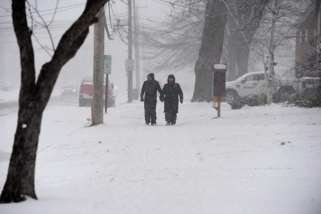
A Lake-Effect Snow Warning has been issued for Southern Herkimer County, New York, as intense snow bands threaten to bring hazardous travel conditions and dangerous wind gusts through Friday night. The National Weather Service (NWS) warns that 3 to 6 inches of snow could fall across the region, with some localized areas seeing up to 8 inches, making travel treacherous and potentially leading to power outages.
The storm is already impacting visibility and road conditions, and with winds gusting up to 50 mph, blowing and drifting snow could make driving extremely dangerous.
What’s Causing This Storm?
Lake-effect snow forms when cold Arctic air moves over the warmer waters of the Great Lakes, picking up moisture and creating intense snowfall in narrow bands. These snow bands can shift unpredictably, leading to rapidly changing conditions, where one moment it’s clear, and the next, roads are covered in several inches of snow.
Herkimer County, downwind of Lake Ontario, is one of the hardest-hit areas when lake-effect snow occurs. With high winds expected to accompany this storm, visibility could drop to near zero at times, creating whiteout conditions and making roads especially hazardous.
Which Areas Will Be Hit the Hardest?
The heaviest snow is expected to fall in southern parts of Herkimer County, particularly areas south of the Mohawk River and along Route 28.
Communities most at risk include:
- Little Falls – Snowfall rates could become intense at times, leading to rapid accumulation.
- Ilion & Mohawk – Wind gusts may cause drifting snow and dangerous road conditions.
- Dolgeville & Newport – Higher elevations could see localized totals of up to 8 inches, creating travel disruptions.
How Bad Could It Get?
This lake-effect snow event will make travel conditions hazardous, particularly during the Friday morning and evening commutes.
Drivers should expect:
- Snow-covered roads and slick conditions, especially on highways and backroads.
- Sudden visibility drops, making it difficult to see ahead.
- Strong wind gusts up to 50 mph, which could knock down tree branches and power lines, potentially leading to power outages.
How to Stay Safe During This Winter Storm
- Avoid unnecessary travel. If you must drive, allow extra time and keep an emergency kit in your vehicle with food, water, blankets, and a flashlight.
- Prepare for power outages. High winds could bring down power lines, so keep batteries, candles, and flashlights on hand.
- Stay updated on weather conditions. Check the latest forecasts from the National Weather Service and local news outlets.
- Dress in layers if you have to be outside. Frostbite and hypothermia can occur quickly in these bitterly cold conditions.
- Stock up on essentials. Food, water, and heating supplies should be ready in case snow makes it difficult to leave your home.
When Will the Storm End?
The lake-effect snow bands are expected to weaken by Friday evening, but blowing and drifting snow could still cause issues through Saturday morning.
This is just a preview of what’s to come, as another potentially powerful winter storm is forecasted to impact the region later this weekend, bringing even more snow and ice.

