
Residents of Tazewell County, Virginia, and Mercer County, West Virginia, should prepare for potential flooding this weekend, as the National Weather Service (NWS) has issued a Flood Watch due to a combination of heavy rain and rapid snowmelt. The storm system is expected to bring 1 to 2 inches of rain from Saturday morning through Sunday evening, significantly increasing the risk of rising water levels, road closures, and dangerous travel conditions.
Why Is This Storm So Dangerous?
The primary concern with this system is the melting snow in higher elevations. Over the past week, several inches of snow have accumulated across the region. Now, with warmer temperatures and heavy rain, all that snow will melt quickly, causing streams, creeks, and rivers to rise fast.
Unlike regular rainfall events, when snowmelt is added into the mix, runoff happens much faster, overwhelming drainage systems and causing flash flooding in low-lying and flood-prone areas.
Which Areas Are Most at Risk?
The Flood Watch covers multiple counties, but the highest risk zones include:
- Tazewell County, Virginia – Low-lying areas near streams and creeks are especially vulnerable.
- Mercer County, West Virginia – Flooding could impact roads, homes, and businesses, particularly in areas near rivers.
- Monroe, Summers, and Greenbrier Counties – Water levels in creeks and rivers could rise dangerously fast if runoff is severe.
If rainfall totals exceed forecasts, flooding could be widespread, affecting neighborhoods, major roadways, and bridges.
How This Could Impact You
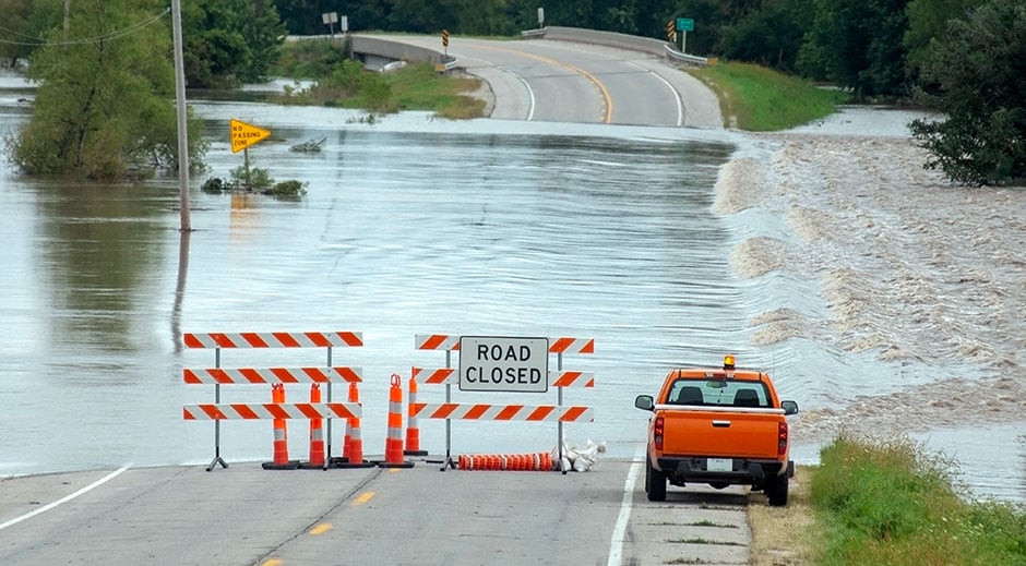
Residents should prepare for potential road closures, particularly in low-lying areas where standing water tends to accumulate. Small creeks and rivers may overflow, making it difficult or even impossible to travel safely.
Urban areas with poor drainage systems are also at risk. Storm drains may become overwhelmed, leading to street flooding. If you live in a flood-prone area, now is the time to take precautions.
What Should You Do to Stay Safe?
- Stay informed. Follow updates from the National Weather Service and local emergency management teams.
- Prepare an emergency kit. Have food, water, flashlights, medications, and important documents ready in case of evacuation.
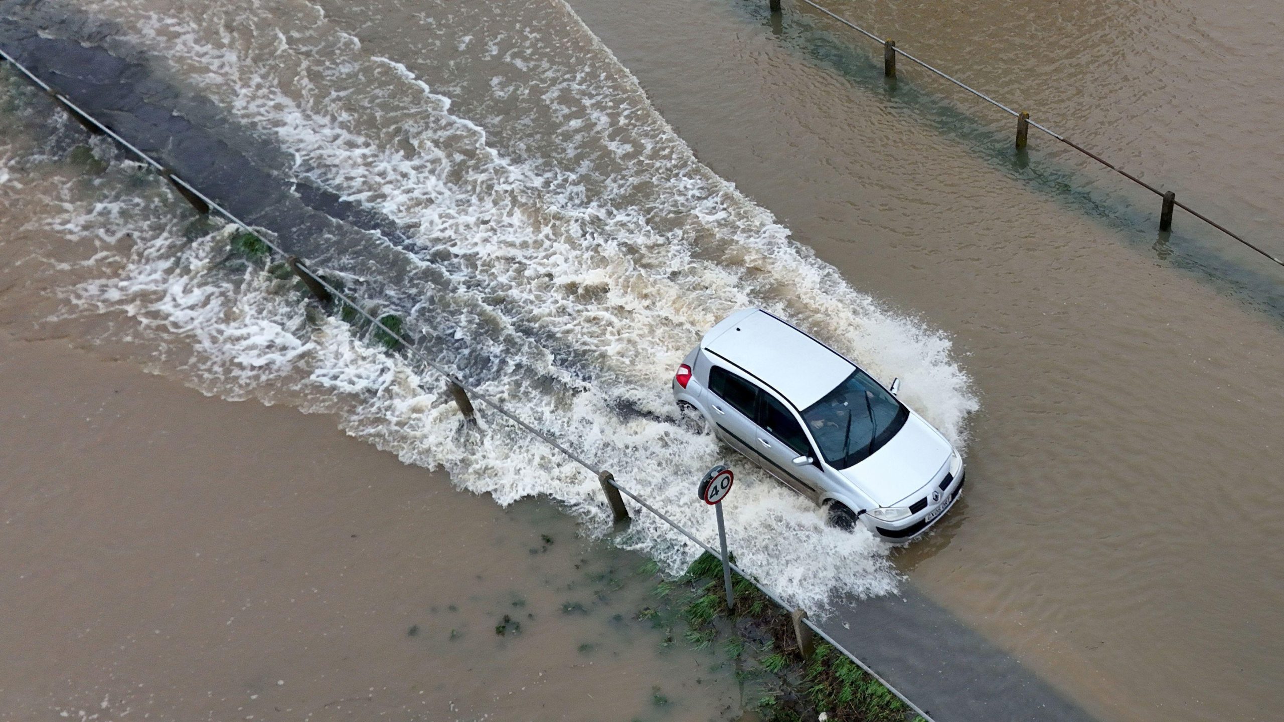
- Avoid flooded roads. Just six inches of moving water can knock a person over, and one foot can sweep a car away. Never attempt to drive through floodwaters.
- Move valuables to higher ground. If flooding is expected in your area, protect important belongings from water damage.
- Be ready to evacuate. If local officials issue evacuation orders, follow them immediately.
What’s Next?
The heavy rain is expected to taper off by Sunday night, but flooding could persist for several days as rivers and creeks continue to rise. Even after the rain stops, water levels may remain high, making travel and cleanup efforts challenging.
Authorities are monitoring the situation closely, and additional flood warnings could be issued if conditions worsen.
For now, residents in Tazewell, Mercer, and surrounding counties should take this flood watch seriously. Flooding can happen quickly and without warning, and preparedness is key to staying safe

