
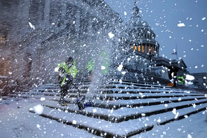
The nation’s capital is on high alert as meteorologists predict a substantial snowstorm set to impact the region starting Tuesday afternoon. The National Weather Service has issued a Winter Storm Watch, cautioning residents about the potential for heavy snow and treacherous travel conditions.
Forecast Overview:
- Monday, February 10: Partly sunny skies with a high near 48°F (9°C) and a low around 29°F (-2°C).
- Tuesday, February 11: Temperatures will drop, with snow beginning in the late morning. Accumulations are expected to reach between 2 to 4 inches (5-10 cm), leading to rapidly deteriorating road conditions. Motorists should anticipate slow and slippery travel. Highs will be around 35°F (2°C), with lows near 30°F (-1°C).
- Wednesday, February 12: A brief period of light snow is anticipated early in the morning, followed by cloudy and cold conditions. The total storm snowfall is projected to be between 1 to 3 inches (3-6 cm). Morning commuters should prepare for slow and slippery travel, with potential rain and ice developing at night. Temperatures will see highs near 36°F (2°C) and lows around 32°F (0°C).
- Thursday, February 13: Periods of morning rain are expected, transitioning to mostly cloudy and warmer conditions later in the day. Highs will reach approximately 53°F (12°C), with lows dropping to around 26°F (-3°C).
- Friday, February 14: The day will turn cloudy and cooler, with highs near 41°F (5°C) and lows around 28°F (-2°C).
Severe Weather Alert:
The National Weather Service’s Winter Storm Watch is in effect from Tuesday afternoon through Wednesday morning. Heavy snow is possible, with total accumulations between 4 and 6 inches, and locally higher amounts in certain areas. Residents should plan for slippery road conditions, which could significantly impact both the Tuesday evening and Wednesday morning commutes. Additional wintry precipitation may continue into Wednesday morning. The hazardous conditions could impact the Tuesday evening and Wednesday morning commutes. Residents are advised to monitor the latest forecasts and consider delaying travel if possible. If travel is necessary, exercise extreme caution, allow extra time to reach destinations, and ensure vehicles are winterized and in good working order.
Safety Recommendations:
- Stay Informed: Regularly monitor local weather updates and heed advisories or warnings from authorities.
- Limit Travel: If possible, delay travel plans during the storm’s peak to avoid hazardous road conditions.
- Prepare Vehicles: Ensure your vehicle is equipped with winter essentials, including an ice scraper, snow shovel, blankets, and emergency supplies.
- Home Preparations: Stock up on necessary supplies such as food, water, medications, and batteries in case conditions worsen.
By staying vigilant and taking proactive measures, Washington, D.C. residents can navigate the upcoming snowstorm safely and minimize potential disruptions.

