
If you live near a river in northern or eastern Maine, you’ll want to pay close attention to the weather this week. Rising temperatures are expected to melt snow quickly, sending more water into rivers and increasing the risk of ice jams and sudden flooding through March 19.
The National Weather Service in Caribou is warning that thinning ice, deep snowpack, and fast-moving meltwater could lead to dangerous flooding in some areas. While there’s no immediate danger yet, conditions could change fast, and now is the time to be ready.
Why Is There a Flood Risk?
A few key factors are coming together to create the perfect setup for ice jam flooding:
- Temperatures are warming up fast – The sudden warm-up will speed up snowmelt, adding more water to already full rivers and streams.
- There’s still a lot of snow on the ground – Parts of northern Maine still have 14 to 25 inches of snow, with some areas buried under more than 30 inches.
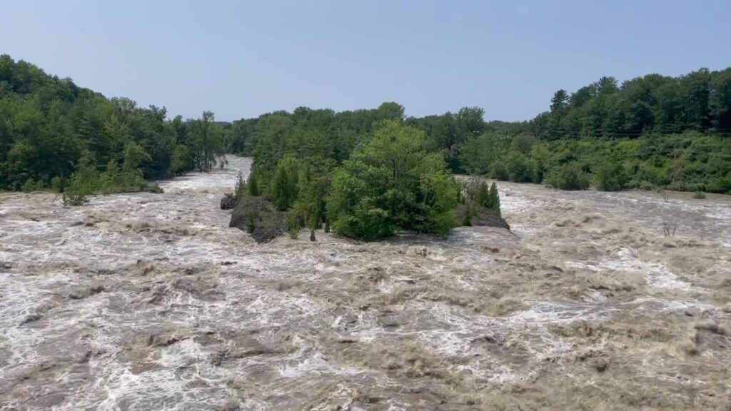
- River ice is breaking up – Ice covering the St. John, Penobscot, and Piscataquis Rivers is thinning and weakening, meaning large chunks could start breaking off and moving downstream.
- Ice jams can form without warning – If ice builds up in a narrow river section or near a bridge, it can block the flow of water and cause flooding in minutes.
What Happens When an Ice Jam Forms?
Unlike regular flooding, where water slowly rises over time, an ice jam can cause water levels to spike suddenly.
- Water can rise several feet in just minutes when a jam blocks a river.
- Flooding can happen with little or no warning, covering roads, yards, and basements before people have time to react.
- Ice chunks can suddenly break loose, sending a surge of fast-moving water and ice downstream.
If you live near a river, stay alert—water levels could look normal one minute and flood your street the next.
Who Should Be Paying Attention?
If you live near the St. John, Penobscot, or Piscataquis Rivers, or any smaller streams in northern and eastern Maine, keep an eye on water levels in the coming days.
- Low-lying areas near rivers are most at risk for sudden flooding.
- Roads near water may become impassable with little warning.
- Homes and businesses close to rivers could see fast-moving water rushing in with little time to react.
There’s no major flooding yet, but with warmer weather on the way, things can change quickly.
How to Prepare for Possible Flooding
- Stay informed – Check local weather updates and river level reports from the National Weather Service.
- Know your evacuation plan – If you live in a flood-prone area, make sure you and your family have a plan in place in case you need to leave quickly.
- Prepare an emergency kit – Keep flashlights, batteries, bottled water, important documents, and warm clothing in a safe, dry place.
- Stay away from riverbanks – Ice and snow near the edges are unstable, and rising water can break up ice suddenly.
- Never drive through floodwaters – Even a few inches of moving water can sweep a car away.
How Long Will the Risk Last?
The ice jam threat will remain high through March 19, especially as temperatures continue to rise and snowmelt increases.
If a jam forms, flooding could last for days until the ice either melts or breaks apart naturally.
For now, the best thing you can do is stay alert, check local conditions, and be prepared in case you need to act quickly.

