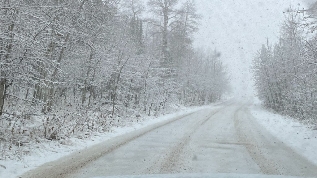
Heads up, Southern Utah! A serious snowstorm is headed your way, and it’s going to pack a punch. The storm is expected to bring heavy snowfall in the higher elevations — up to 12 inches by Thursday evening. Whether you’re traveling or just enjoying the winter scenery, conditions are about to get tricky, especially in the mountains.
What’s Going on Right Now:
Southern Utah is currently in the thick of a snowstorm, and it’s only going to get worse before it gets better. Areas like Zion National Park, Bryce Canyon, and the Wasatch Mountains are already seeing snowfall, and it’s expected to pick up over the next 24 hours. The National Weather Service has issued a Winter Storm Warning for these areas, where 1-2 inches of snow per hour could accumulate. In some spots, the snow will be heavy and fast, making driving and travel more than a little challenging.
This isn’t your average light dusting — it’s the kind of snowstorm that brings icy roads, poor visibility, and windy conditions, making outdoor plans and travel through the mountains a bit of a gamble.
Where the Snow Will Hit the Hardest:
If you’re heading to the mountains, be prepared for some serious snow accumulation. Areas like Zion and Bryce Canyon could get anywhere from 6 to 12 inches of snow, and the higher elevations, like the Manti-La Sal Mountains and Markagunt Plateau, will see the heaviest snowfall. Even lower elevations around St. George will be affected, although they’re expecting less snow overall, the roads are still going to be slick, especially at night when temperatures drop.
If you were planning on a scenic drive or hike, it’s worth checking the forecast first. Mountain roads will be dangerous, and in some areas, snow could make driving slower and riskier than usual.
What You Need to Know Before You Head Out:
If you’re set on traveling or exploring the mountains, here’s what you should consider:
-
Stay Home If You Don’t Have to Go: Seriously, if you don’t need to be in the mountains right now, stay put. The snow is going to keep falling, and conditions will only worsen as the storm continues. If you do have to go out, make sure your car is prepared with snow tires, chains, and an emergency kit packed with essentials like water, snacks, and blankets.
-
Check Road Conditions Before You Leave: Before you even think about hitting the road, check the latest updates on road conditions. The Utah Department of Transportation has real-time info on closures, chain requirements, and road conditions, so you’ll know exactly what you’re up against.
-
Expect Delays: Even if you’re prepared, don’t expect to get anywhere fast. Snow, ice, and poor visibility are going to slow things down. Give yourself extra time and be patient, especially if you find yourself stuck in traffic or dealing with road closures.
-
Avalanche Risk: With all this snow, there’s a real risk of avalanches in the backcountry. If you’re planning to do any off-the-beaten-path activities, like skiing or snowboarding, check the avalanche forecast first. Don’t venture into high-risk areas unless you’re properly trained and equipped.
Why This Storm Matters:
Southern Utah isn’t exactly known for heavy snowstorms, but this one is going to be different. The combination of strong winds, heavy snow, and freezing temperatures will make things dangerous in the mountains, especially if you’re driving. Even in places like St. George, where snowfall is lighter, icy roads and slippery spots will create hazards for commuters and travelers.
If you’re planning on heading to the mountains, expect poor road conditions, limited visibility, and possible road closures. Be cautious and aware of the risks — this storm is not something to ignore.
How to Stay Safe in This Storm:
If you’re already dealing with the snowstorm, or if you need to head out, here are some essential safety tips:
-
Dress Warmly and Layer Up: If you have to go outside, bundle up! Dress in layers so you can adjust to the cold, and make sure your gear is waterproof to stay dry. Whether you’re walking around or hiking, you’ll want to stay as warm and dry as possible.
-
Stay Indoors If You Don’t Have to Be Outside: If you’re not planning to do anything urgent, stay inside. The storm is serious enough that it’s safer to wait until it clears up. Plus, it’ll be a lot more comfortable to stay warm and cozy while the snow falls.
-
Drive Slowly and Carefully: If you absolutely need to travel, take it slow. Snow, ice, and poor visibility can make roads treacherous, so make sure you give yourself plenty of space between you and other drivers. Black ice can form unexpectedly, so stay alert and always use low beams in the snow to improve visibility.
-
Stay Updated on Weather Conditions: Things can change fast when a storm like this is moving in. Make sure you’re checking the weather regularly to stay up to date on conditions and alerts.
What’s Coming Next:
The storm should taper off by Thursday evening, but that doesn’t mean things will be smooth sailing right away. Even after the snow stops, icy patches and slippery spots will stick around for a while, especially early in the morning when temperatures are at their lowest. If you have travel plans for the weekend, don’t assume the roads will be clear immediately. It’s going to take some time for conditions to improve.


